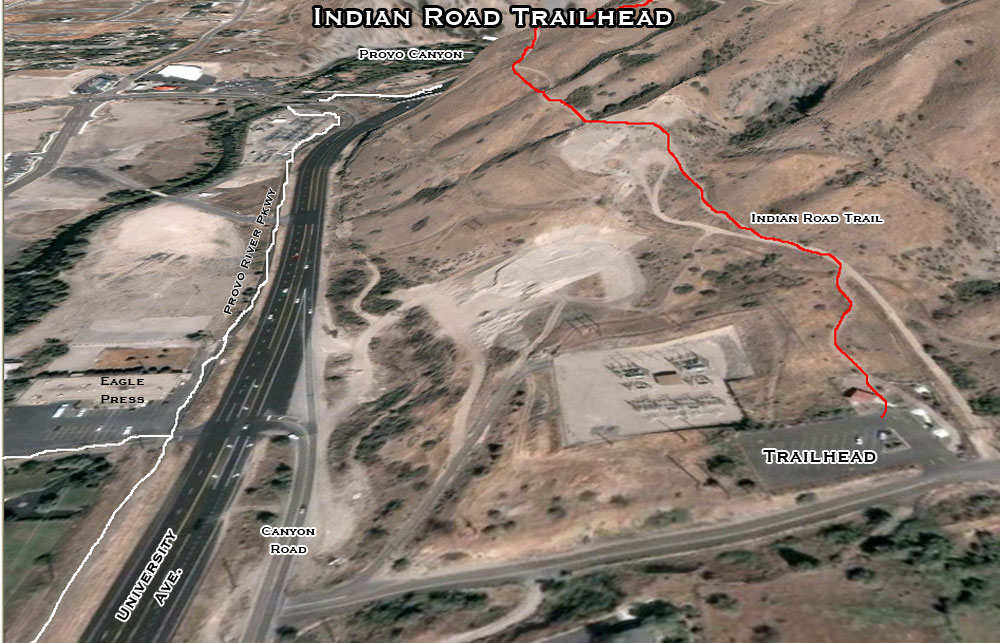
| Just under a mile South of Provo Canyon is the Indian Road Trailhead. It is relatively unknown due to it's slightly hidden location but it's easy to find and it's a great alternative to starting your run at the mouth of Provo Canyon. | |
| 1. Indian Road Trailhead (Shooting Range Trail, Bonneville Bridal Veil, The Random Run) | This is really the only trail that branches off directly from this trailhead. There is a steady 5-10 minute climb (just follow the Bonneville Shoreline Trail markers) up through the switchbacks until you come to a trail convergence with stunning views of Mt. Timpanogos and the Provo Canyon Cliffs. The lower trail (1) leads to the shooting range in Provo Canyon, the upper trail (2) is the "Bonneville Bridal Veil" section of the Bonneville Shoreline Trail and/or after a couple of miles you can take a right at another BST marker on a great section that heads out over the North Provo Foothills towards rock canyon (the Random Run). |
| Provo River Trail Split | To the West you can see where the Provo River "trail" splits and either continues to follow University or goes and winds through Riverwoods (much nicer). |

