

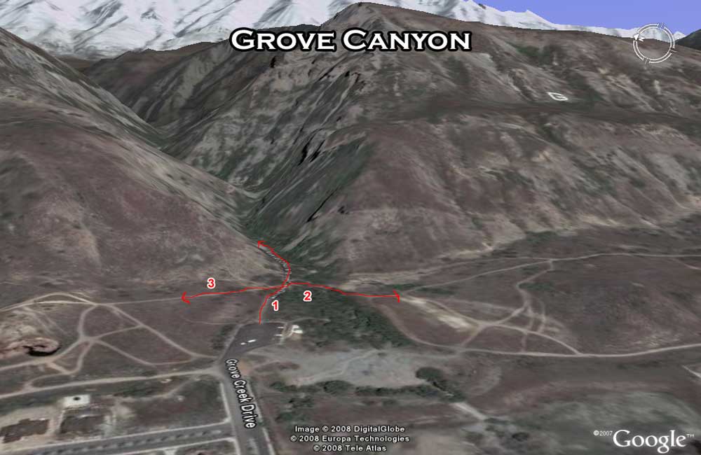
| The Bonneville Shoreline Trail connects through this trailhead which offers bathrooms and is also the starting point to go up Grove Canyon. Directions from Orem: Take State Street North to the Purple Turtle and turn right on Pleasant Grove 100 East, after about a mile, turn right on Grove Creek Drive and go straight up the parking area. | |
| 1. Blue Ledges (Grove Canyon Trail) | Makes its way across many ledges of blue colored shale (hence the name) up Grove Canyon over a waterfall to Curly Springs. Take the trail over and down Battle Creek and come back on the BST for a great round trip. |
| 2. Bonneville Shoreline (BST) to Battle Creek | Mostly dirt road; Connects over to Battle Creek Trailhead. |
| 3. Bonneville Shoreline (BST) to A.F. Canyon | Mixed dirt road and single track; Still in development and not marked well but hard to get lost. Will connect to American Fork Canyon. |