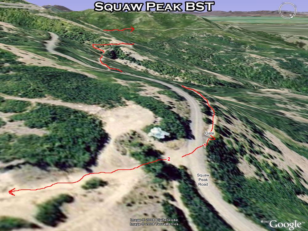
| Turn onto Squaw Peak Rd. 2 miles up Provo Canyon---These trails are located 1.5 miles up the road with a gate on the right (west) side of the road and a small gulch on the left side of the road. Park on either side. This is a great place to start if you want a soft surface experience with very few hills---these sections are mainly fast and flat offering great views of the valley and Provo Canyon. | |
| 1. Bonneville Indian Road (BST) | Trail goes out to the mouth of Provo Canyon down to the Indian Road Trailhead or go left at the BST signpost halfway to go out to the Gazebo above Eastlawn for a nice loop and multiple trails in the area. |
| 2. Bonneville Bridal Veil (BST) | This trail goes to Bridal Veil and also hooks on with the Sylvia Trail that goes STRAIGHT UP to Hope Campground. |
| Squaw Peak Road | This is the infamous 4.5 mile beast of a road. (Paved) |

